
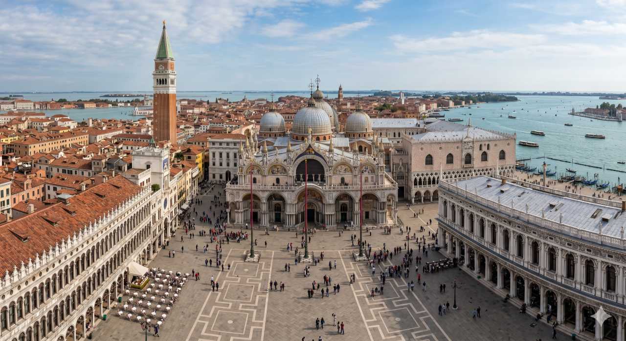
St Mark’s Basilica (Basilica di San Marco) is the undisputed crown jewel of Venice. With its dazzling Italo-Byzantine architecture, soaring domes, and more than 85,000 square feet of luminous gold mosaics, it stands as an enduring monument to the historical wealth, geopolitical power, and artistic brilliance of the Venetian Republic.
For centuries, this extraordinary cathedral has served as the emotional and physical anchor of the city. However, navigating Venice to reach it can be a beautifully bewildering experience. Venice is an urban labyrinth unlike any other on Earth—a floating masterpiece comprised of 118 small islands, intersected by roughly 150 canals, and stitched together by more than 400 stone bridges. There are no cars, no buses, and no wide modern grid systems. Instead, you must rely on historic waterways and a dense network of tight, winding alleys (calli).
Whether you are arriving by water or conquering the maze of stone pathways on foot, understanding the unique transit dynamics of Venice is essential for a seamless journey. This comprehensive guide details exactly where the Basilica is located and provides exhaustive, step-by-step navigation strategies to reach it by foot, water bus (vaporetto), and gondola.
- Campo San Bartolomeo
- Mercerie
- Under the Clock Tower
- St. Mark’s Square
- Calle del Traghetto
- Gondola ferry across the Grand Canal
- Santa Maria del Giglio
- Short walk to the square
- Piazzale Roma stop
- Line 2 via the Giudecca Canal
- San Zaccaria
- St. Mark’s Square
- Ferrovia stop
- Line 1 (scenic) or Line 2 (faster) down the Grand Canal
- San Marco
- Lista di Spagna
- Strada Nova
- Rialto (Campo San Bartolomeo)
- Mercerie
- St. Mark’s Square
- Constitution Bridge
- Strada Nova
- Rialto
- Mercerie
- St. Mark’s Square
- Gondola station just behind the square
- Private ride through the inner canals
- Back near St. Mark’s Square
💡 Tip: the quickest way from the station is Line 2. For the most beautiful arrival, take Line 1 down the entire Grand Canal and step off right in front of the Doge’s Palace.
Where is the Basilica Located in Venice
To find St Mark’s Basilica, you must head to the absolute heart of Venice’s civic and religious history: Piazza San Marco (St Mark’s Square). Located within the San Marco sestiere (neighborhood), the Basilica sits prominently at the eastern end of the square, immediately adjacent to the grand Doge’s Palace (Palazzo Ducale) and facing out toward the open waters of the Venetian Lagoon.
Geographical Context and Coordinates
Geographically, the Basilica is situated in the southeastern curve of the main fish-shaped island cluster of Venice.
Understanding Venetian Topography
When looking for the Basilica, it helps to understand that Venice is divided into six historic districts called sestieri: San Marco, Cannaregio, Castello, Dorsoduro, San Polo, and Santa Croce.
The Basilica rests entirely within the San Marco district, which operates as the central hub toward which almost all pedestrian signs in the city point. No matter where you land in Venice—whether at the main railway station at the western edge or the remote corners of Castello to the east—the entire city’s geography is conceptually organized to funnel foot traffic and watercraft directly toward this iconic cathedral.
How to Get There by Foot
Walking through Venice is an unforgettable sensory experience, but it requires patience, stamina, and a willingness to embrace navigation errors. Because the city’s layout dates back to the Middle Ages, streets curve unpredictably, dead-end abruptly into canals, or narrow down to walkways barely wide enough for a single person.
Fortunately, the city administration has installed a yellow directional signage system painted on the corners of historic buildings. To reach the Basilica, you simply need to follow the signs marked “San Marco.” Below are the detailed walking routes from the city’s primary entry hubs.
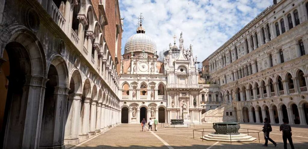
Route 1: From Venezia Santa Lucia Railway Station (Stazione F.S. Santa Lucia)
If you arrive in Venice by train, you will exit onto the steps of Santa Lucia Station, facing the Grand Canal. Walking to St Mark’s Basilica from here takes approximately 35 to 50 minutes depending on your pace and crowd levels, covering roughly 2.5 kilometers (1.5 miles).
Route 2: From Piazzale Roma (Bus Terminal and Parking Hub)
Piazzale Roma is the final destination for land vehicles, including airport buses from Marco Polo and Treviso airports, local public buses, and cars utilizing the municipal parking garages. Walking from Piazzale Roma to the Basilica takes 40 to 55 minutes.
Practical Tips for Walking in Venice
How to Get There by Vaporetto
The vaporetto is Venice’s iconic public water bus system, operated by ACTV (Azienda Consorzio Trasporti Veneziani). Taking a vaporetto to St Mark’s Basilica is highly recommended; it saves your feet from strenuous walking and provides an incomparable, cinematic introduction to the city’s architecture from the water.
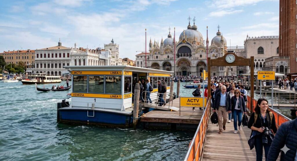
Choosing the Right Lines and Directions
Several key vaporetto lines service the area immediately surrounding Piazza San Marco. The most critical lines for tourists are Line 1, Line 2, and Line 5.1/5.2. Understanding the difference between these options will save you significant travel time.
What matters most to you?
Stops at every station along the Grand Canal. Ideal for sightseeing and photography.
Skips minor stops along the Grand Canal. Much faster during peak commuting hours.
Circles the outer edge of the main island and skips the Grand Canal entirely. Arrives at San Zaccaria, a short walk from the square.
💡 Tip: Line 5.1 and 5.2 run in opposite directions around the island. Check which one heads south via the Giudecca Canal from your stop, so you don’t take the long way round.
Step-by-Step Vaporetto Boarding Guide
From Santa Lucia Train Station or Piazzale Roma
Navigating the San Marco Vaporetto Stations
When approaching the San Marco area, the water bus will stop at one of three interconnected floating docks spaced along the Riva degli Schiavoni waterfront. Depending on your specific boat, you will disembark at one of the following stations:
From Other Key Areas of Venice
How to Get There by Gondola
Using a gondola to reach St Mark’s Basilica is the ultimate romanticized Venetian luxury. However, it is vital to distinguish between the two types of gondola experiences available in the city: the Traghetto (a shared public ferry used for practical canal crossings) and the Private Luxury Gondola Tour (a private, chartered excursion).
Because gondolas are non-motorized, manually rowed vessels, they cannot navigate open lagoon waters over vast distances or fight strong currents with heavy crowds onboard. They are best utilized for short, deliberate approaches to the San Marco district.
Option 1: The Traghetto (The Budget-Friendly Canal Crossing)
If you are walking to the Basilica from the opposite side of the Grand Canal (such as the San Polo or Dorsoduro districts) and do not want to walk all the way to the Rialto or Accademia bridges to cross, you can use a Traghetto.
A traghetto is a large, unadorned gondola rowed by two gondolieri. It acts strictly as a public foot ferry moving back and forth across specific points of the Grand Canal where bridges are absent.
How to Use a Traghetto to Reach the Basilica
Option 2: Private Gondola Hire (The Premium Route)
For a fully private, classic experience where a gondolier navigates you directly through the atmospheric inner canals to the steps of the Basilica’s neighborhood, you can hire a private gondola charter.
Official Rates and Regulations
Gondola fares are heavily regulated by the city of Venice to prevent price gouging.
Best Stations (Stazioni Gondole) for a Basilica Approach
To ensure your gondola ride drops you off as close as humanly possible to St Mark’s Basilica without requiring a massive walk afterward, you should charter your boat from specific gondola stations located in the immediate vicinity of San Marco:
Crucial Etiquette and Booking Rules
1. What is the closest water bus (vaporetto) stop to St Mark’s Basilica?
The closest vaporetto stops are San Marco Vallaresso and San Marco Giardinetti, both located just a 2-to-3-minute flat walk from the square. Alternatively, the San Zaccaria station is a major hub located about a 5-minute walk away along the Riva degli Schiavoni waterfront promenade.
2. Can I take a water taxi directly to the steps of the Basilica?
No. Motorized water taxis (motoscafi) are prohibited from entering Piazza San Marco itself. The closest a private water taxi can drop you off is at the nearby piers along the Grand Canal (near Harry’s Bar/Vallaresso) or the Rio de Palazzo canal right behind the Doge’s Palace. From there, you must walk 2 to 3 minutes to reach the cathedral entrance.
3. How long does it take to walk to the Basilica from the Venice train station?
Walking from Venezia Santa Lucia Railway Station to St Mark’s Basilica takes approximately 35 to 50 minutes (about 2.5 kilometers or 1.5 miles). The timeline depends heavily on your walking pace, your ability to navigate the winding streets, and the density of tourist crowds along the main Strada Nova route.
4. Is the walking route from Piazzale Roma to St Mark’s accessible for strollers or wheelchairs?
It is highly challenging. While the main walking paths are paved, the route from Piazzale Roma to the Basilica requires crossing numerous historic stone bridges, most of which feature steps rather than ramps. For travelers with strollers, heavy luggage, or mobility constraints, taking Vaporetto Line 1 or Line 2 is a much smoother, step-free alternative.
5. Which vaporetto line is the fastest way to get there from the parking garages?
From the Piazzale Roma parking hubs, Vaporetto Line 2 (Express) running via the Giudecca Canal is generally the fastest public transit option, taking about 25 to 30 minutes. Line 1 also reaches San Marco but acts as a local service, stopping at every station along the Grand Canal and extending the journey to roughly 45 minutes.
6. Are there direct boat transfers from Marco Polo Airport to St Mark’s Square?
Yes. The Alilaguna water shuttle service runs direct routes from the airport boat pier into the heart of Venice. Both the Blue Line (Linea Blu) and the Gold Line (Linea Oro) stop at the San Marco Giardinetti or San Zaccaria docks, taking roughly 1 hour and 15 minutes to reach the Basilica neighborhood.
7. How do I find my way to the Basilica if my phone loses GPS signal in the alleys?
Venice’s high, narrow stone walls frequently disrupt satellite signals. To navigate without GPS, look up at the corners of the historic buildings. The city maintains a system of yellow directional signs painted on the walls; simply follow the signs marked “Per San Marco” (To St Mark’s) to reach the square.
8. Can a traditional gondola take me directly to the Basilica entrance?
A gondola cannot drop you off inside the pedestrianized square, but it can get you incredibly close. You can hire a gondola to navigate the inner canals directly behind the cathedral, disembarking at the Bacino Orseolo station or the canal locks next to the Doge’s Palace, leaving you with less than a 1-minute walk to the front doors.
9. What is a “Traghetto” and how does it help me get to San Marco?
A traghetto is a large, unadorned shared gondola used by locals as a cheap water ferry to cross the Grand Canal at points where there are no bridges. If you are exploring the Dorsoduro or San Polo neighborhoods, taking the traghetto across to the San Marco side costs roughly €2 and saves you from walking long distances out of your way to find a bridge.
10. Is it easy to walk to St Mark’s Basilica from the Rialto Bridge?
Yes, this is one of the most straightforward walks in Venice. From the foot of the Rialto Bridge on the San Marco side, you enter a historic network of shopping alleys called the Mercerie. Following the pedestrian flow through these streets leads you straight under the St Mark’s Clock Tower and directly into the square in about 10 to 15 minutes.